Sale on canvas prints! Use code ABCXYZ at checkout for a special discount!

Boundary: Bleed area may not be visible.


by Vincent Monozlay
$41.95
Size
Rope Color
Image Size
Product Details
Our weekender tote bags are chic and perfect for a day out on the town, a staycation, or a weekend getaway. The tote is crafted with soft, spun poly-poplin fabric and features double-stitched seams for added durability. The 1" thick cotton handles are perfect for carrying the bag by hand or over your shoulder. This is a must-have for the summer.
Design Details
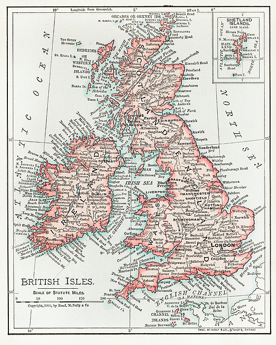
Universal Atlas of the World, A cartographic map of the British Isles. published in 1900. Digitally enhanced from original plate.
Care Instructions
Spot clean or dry clean only.
Ships Within
2 - 3 business days

Drawing

Canvas Print

Framed Print

Art Print

Poster

Metal Print

Acrylic Print

Wood Print

Greeting Card

iPhone Case

Throw Pillow

Duvet Cover

Shower Curtain

Tote Bag

Round Beach Towel

Zip Pouch

Beach Towel

Weekender Tote Bag

Portable Battery Charger

Bath Towel

Apparel

Coffee Mug

Yoga Mat

Spiral Notebook

Fleece Blanket
Universal Atlas of the World, A cartographic map of the British Isles. published in 1900. Digitally enhanced from original plate.
In 1968, I was born in Nitra, Czechoslovakia (now Slovakia). My father, an amateur photographer, was the inspiration for my interest in photography and art. I enjoy photography, HDR photography, restoring and colouring old photos, portraits, photo art, AI art and old masters.
$41.95


There are no comments for Map of the British Isles 1900. Click here to post the first comment.